These last few days have been mired in disappointment and anger as my hometown has experienced the worst flooding it has ever received. Part of this event involved driving a boat up to my parent’s house, the home that my father built himself and completed when I was born. This house is 34 years old and my family and friends have built many memories running around the land my parents essentially transformed from a swamp to a high patch of dry land that was the envy of many people.
Today I saw that die. Today I saw a piece of my dad go. I saw my mother shattered. My sister stayed strong and it was all I could do to console my father as he reassured me that “everything is gone, it’s all gone.” The emotion from seeing this was only strengthened when my mother echoed the very same sentiment. My parents got their clothes and managed to save a few of their vehicles, two boats, and some ATVs. They got a few suits of clothes and my dad’s guns. All of the pictures and sentimental objects were tossed on the bed because that worked in the flood of 1999, where the water was into my childhood home up to around 10-12 inches.
Today we learned that this trick was ineffective. My parents made it out with more than many of those friends and families through Burr Ferry and Evans. Some people were left with the clothes on their back and a bank account. Some of them don’t have a place to stay, so they are getting “discounts” at hotels for the night. This flood has been exponentially more shattering for my hometown than any previous event. Previous floods, hurricanes, tornadoes – everything.
Below is a photo album that I have created to share with Facebook. I chose to use my own web page because I am more comfortable sharing my thoughts with each image, and it gives me a chance to really talk about each photo my way.
The photos you are about to see are more than just photographs. They are a marker of my life. I am approaching middle age and my parents, who are in the dawn of their (forced) retirement, have essentially been dealt a terrible blow. One that has essentially shaken their foundation.
These photos are the evidence of my history coming to a shuddering close. There are no photos anymore. There are no birthday cards my mom saved and no scrapbooks. There are no old baby clothes and baby shoes. There are no wall photos and no more mounted deer heads celebrating my father’s accomplishments as a hunter, nor is there an 11 lbs bass mounted on the wall.
What do we have now?
Click the images for high res versions that look better.
This little guy, or should I say, big guy, was about 15 feet up in a tree and he looked miserable. We wanted to get him down, but if you know anything about wild raccoon, they are a little ornery. By a little ornery, I mean they will try to murder you, starting with your face. My cousin, Harvey, said “Yeah, we could get him, but he would probably be ungrateful.” I hope he makes it. He was asleep. This was taken while we were returning to the boat trailer on what we river rats called the Wing Road.
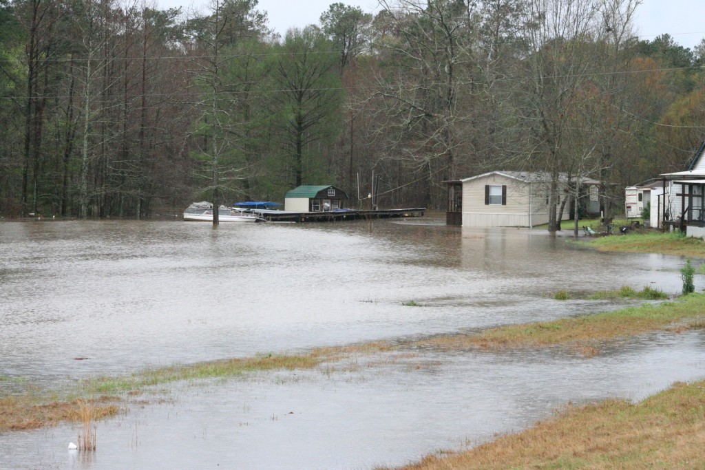
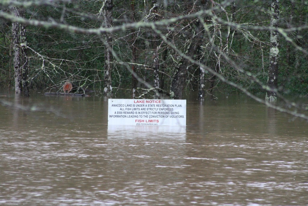
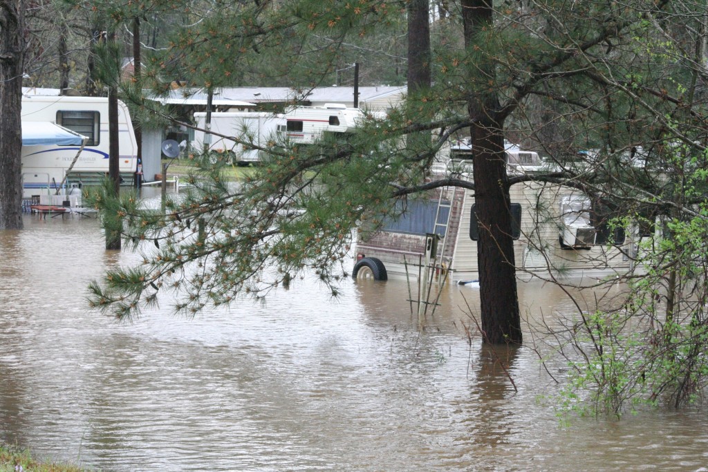
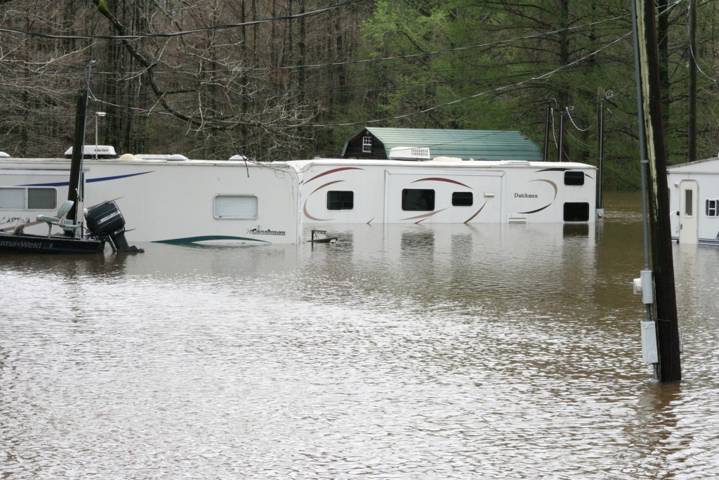
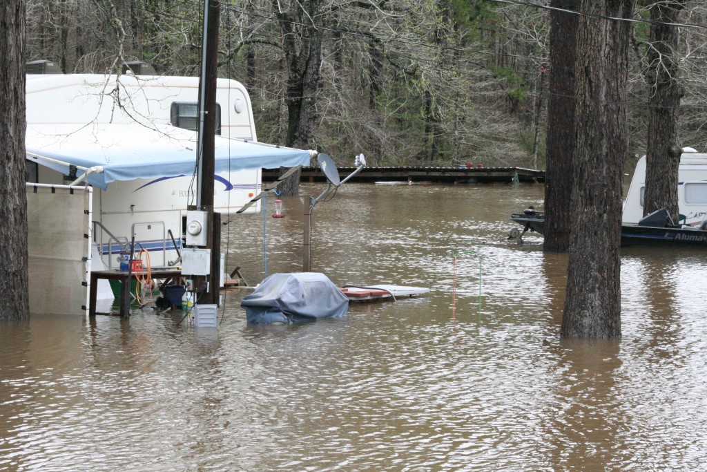
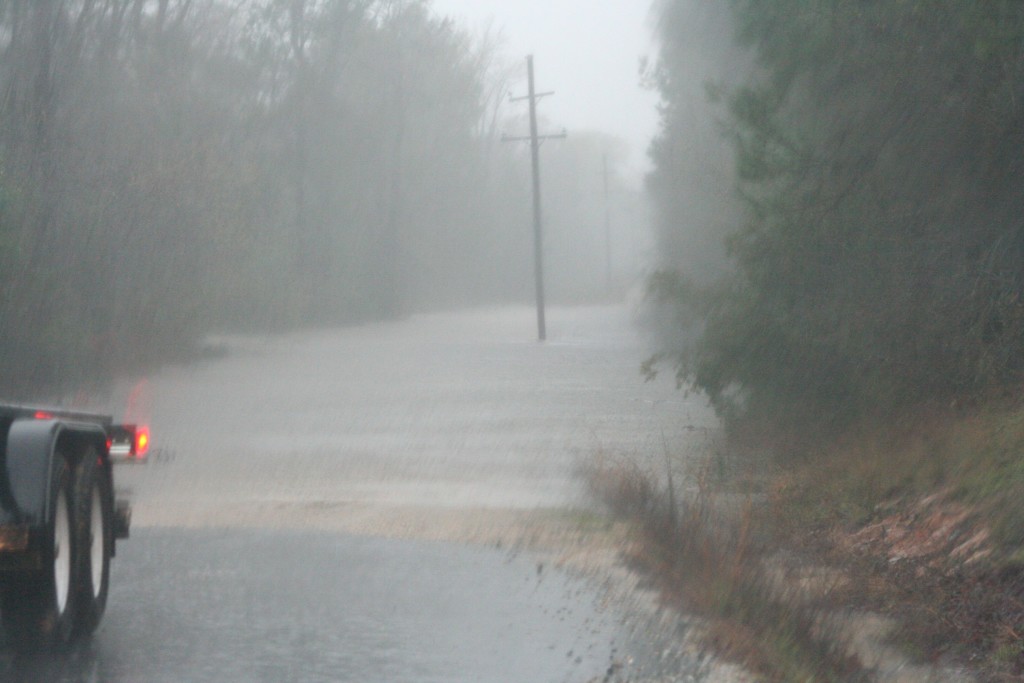
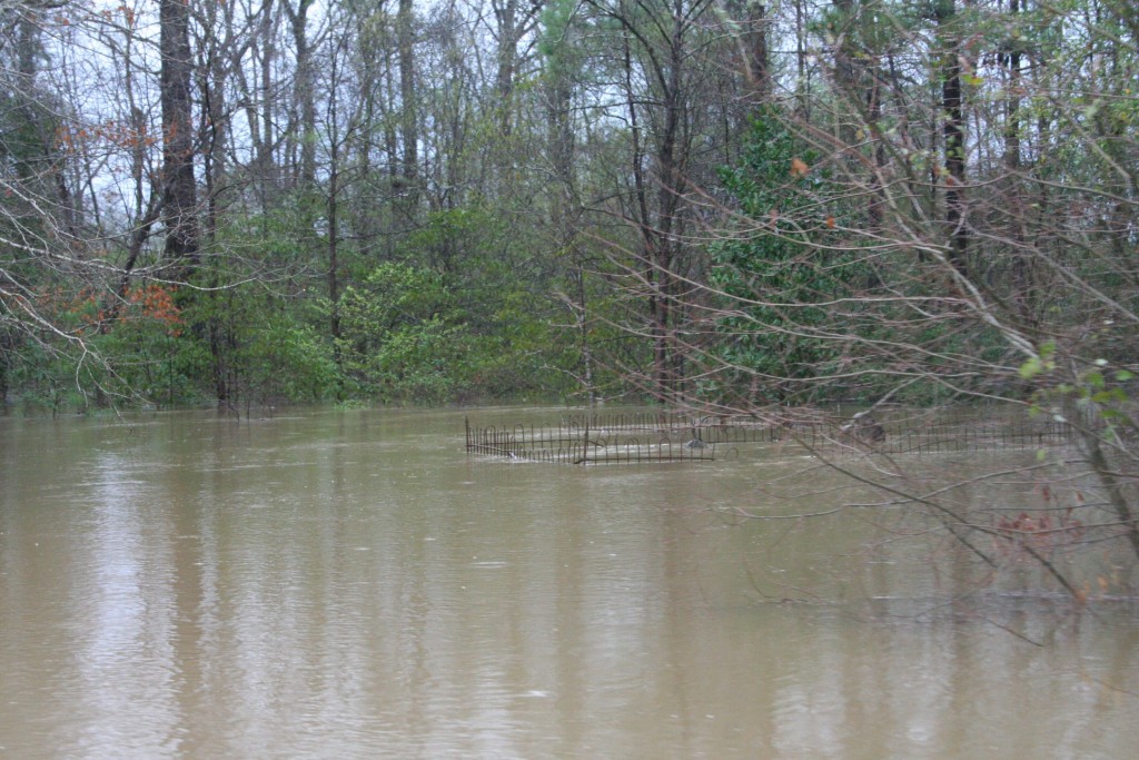
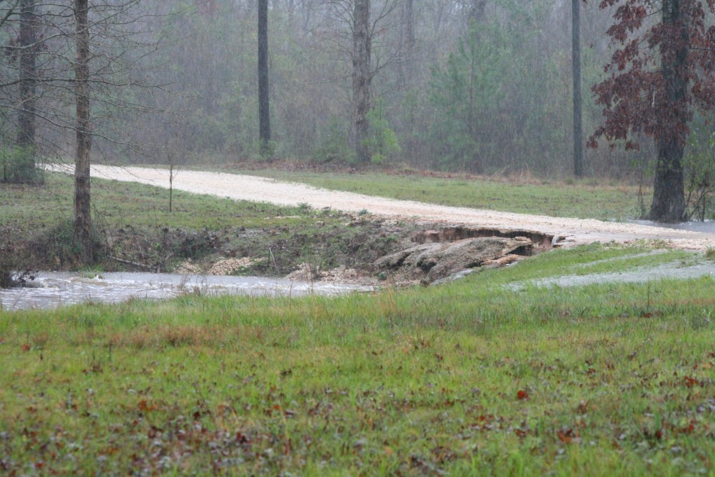
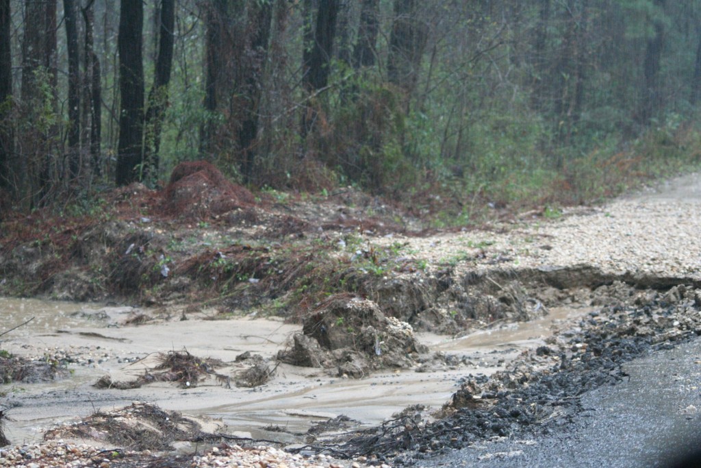
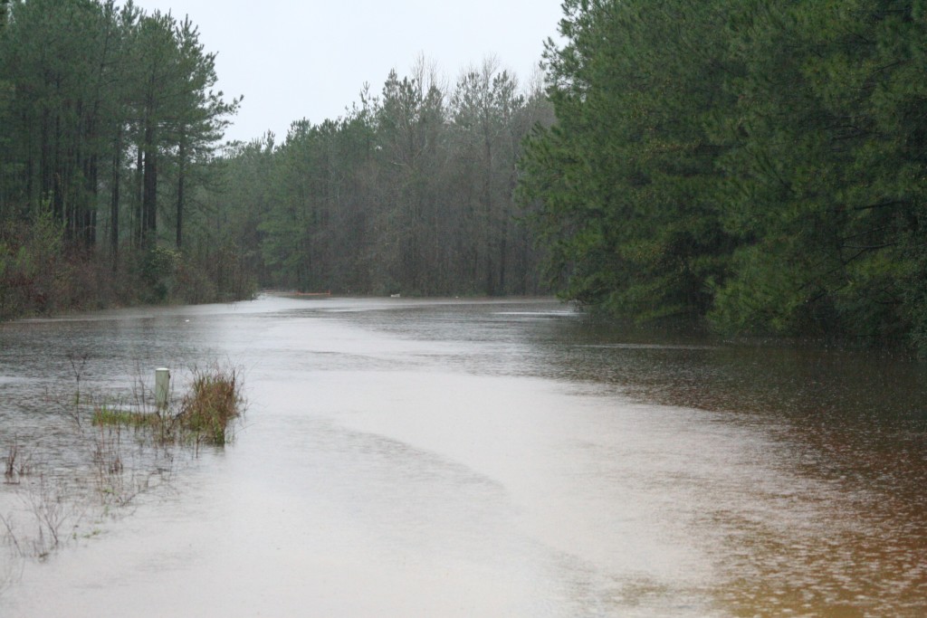
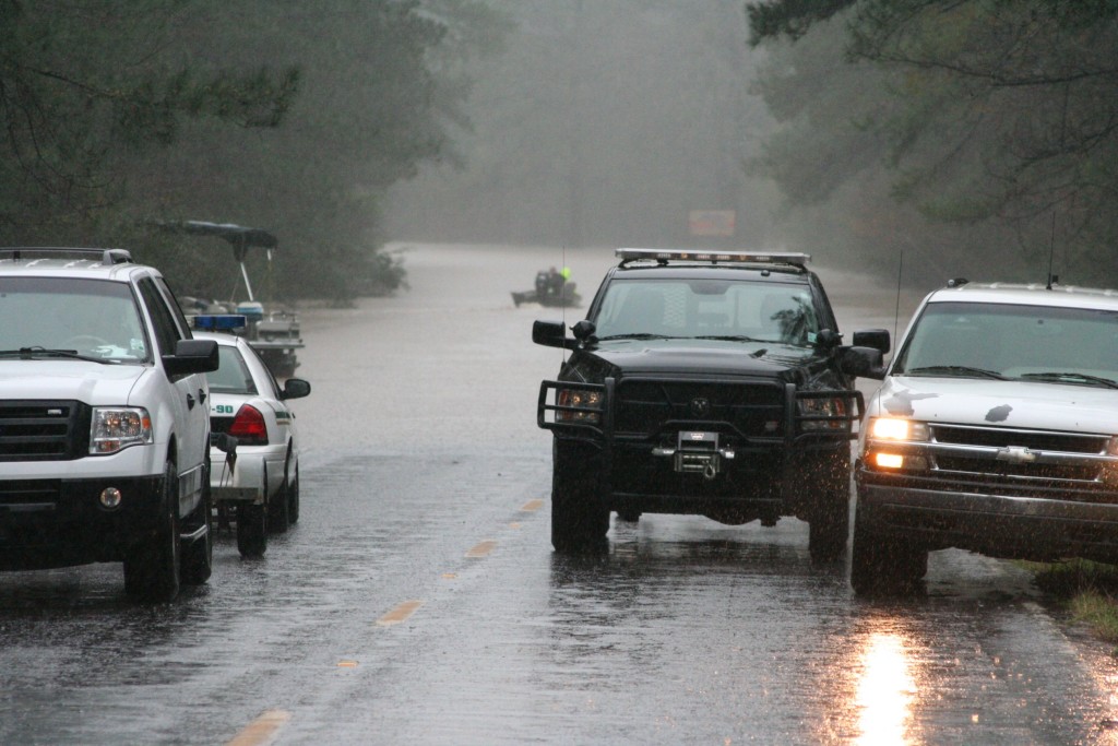
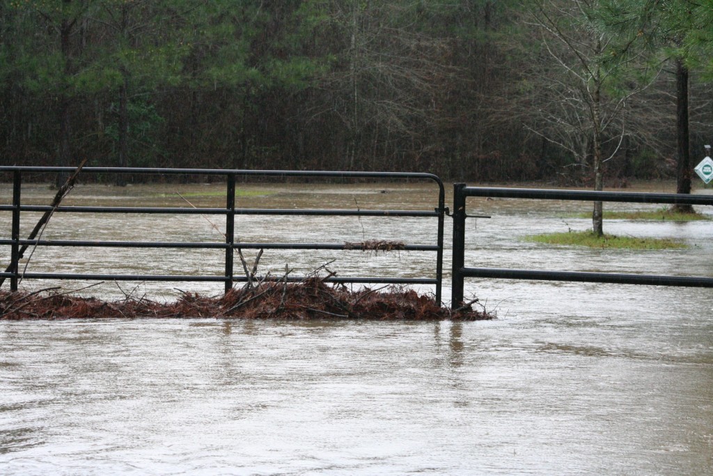
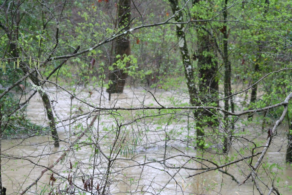
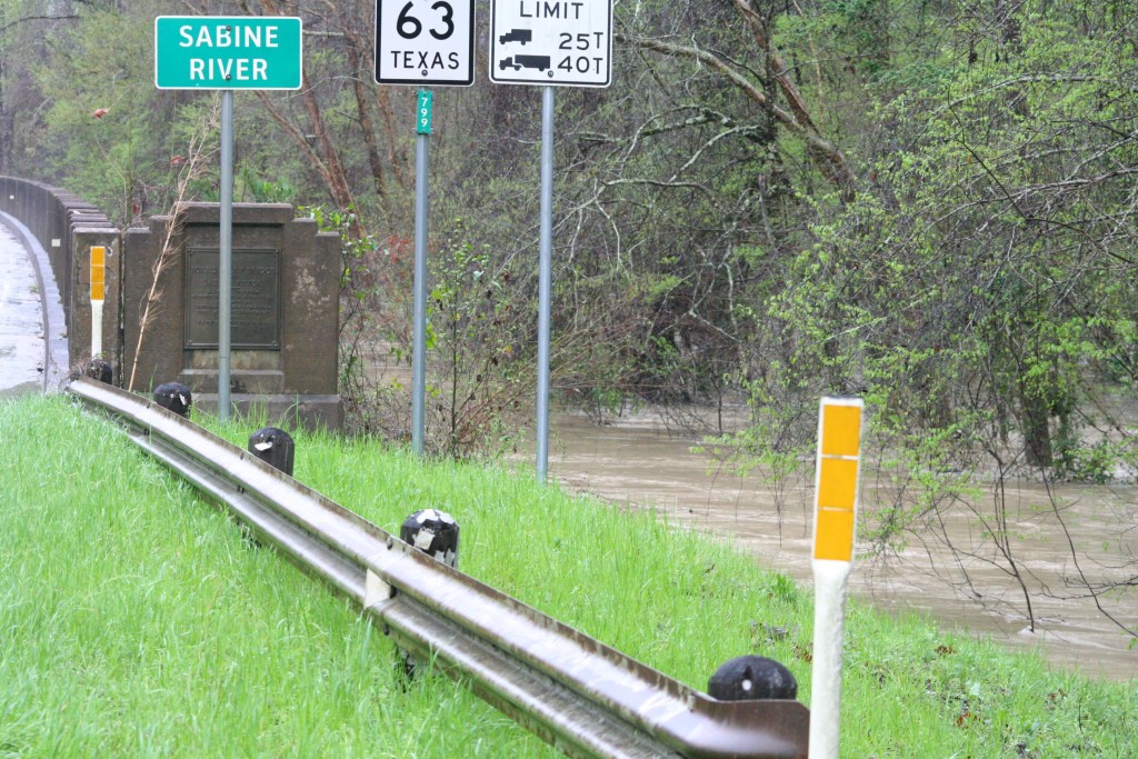
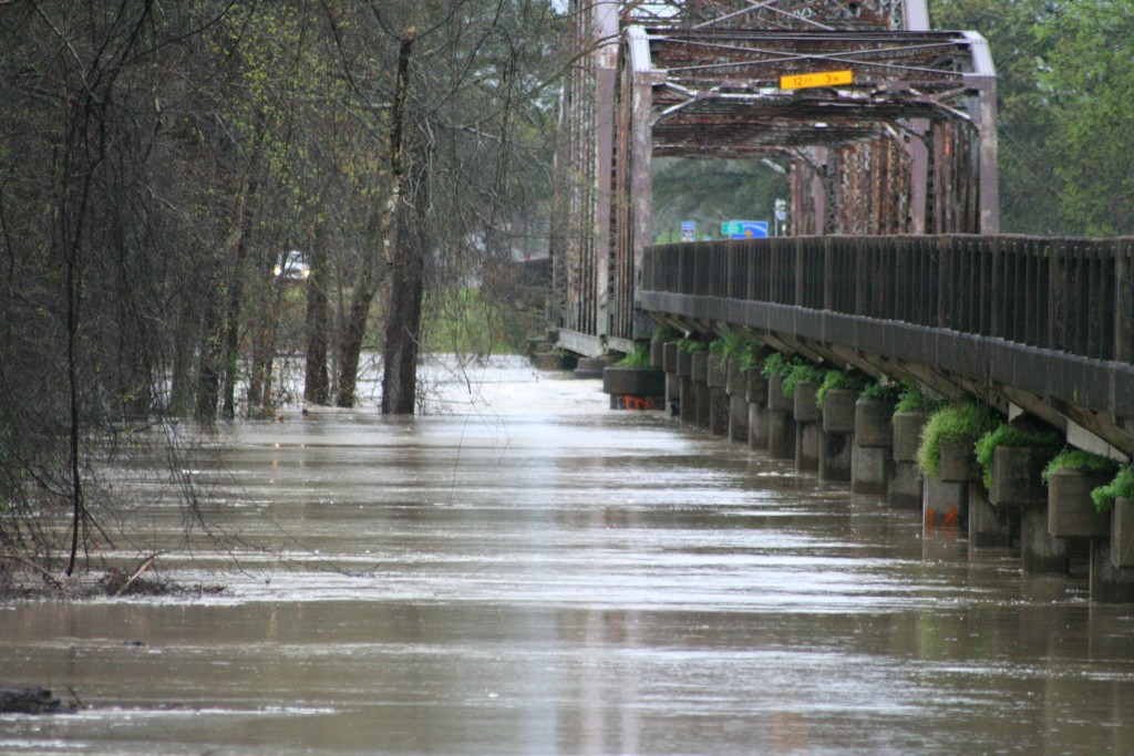
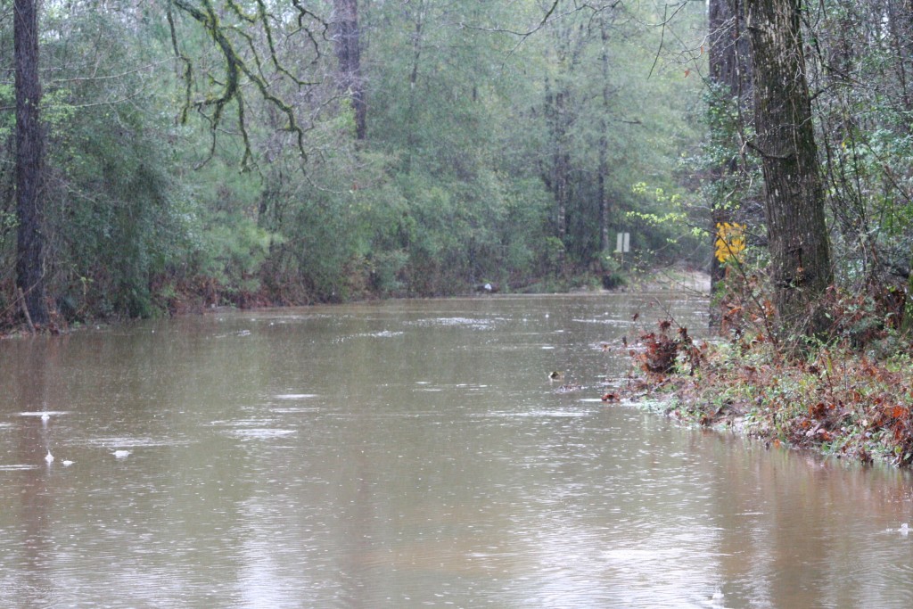
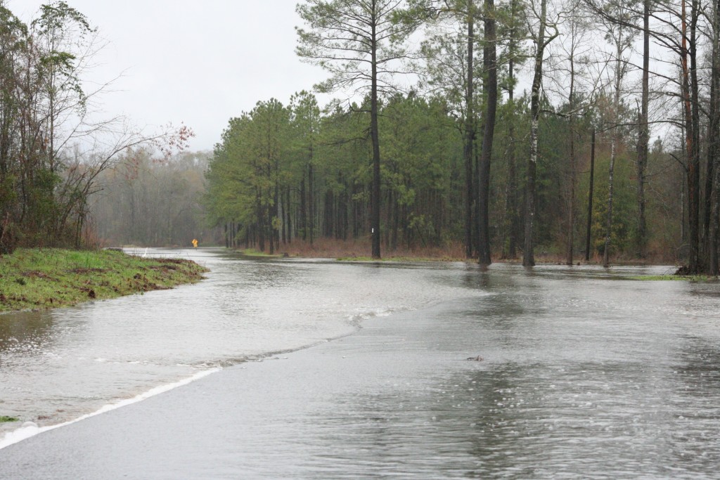
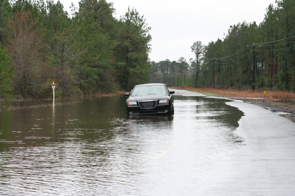
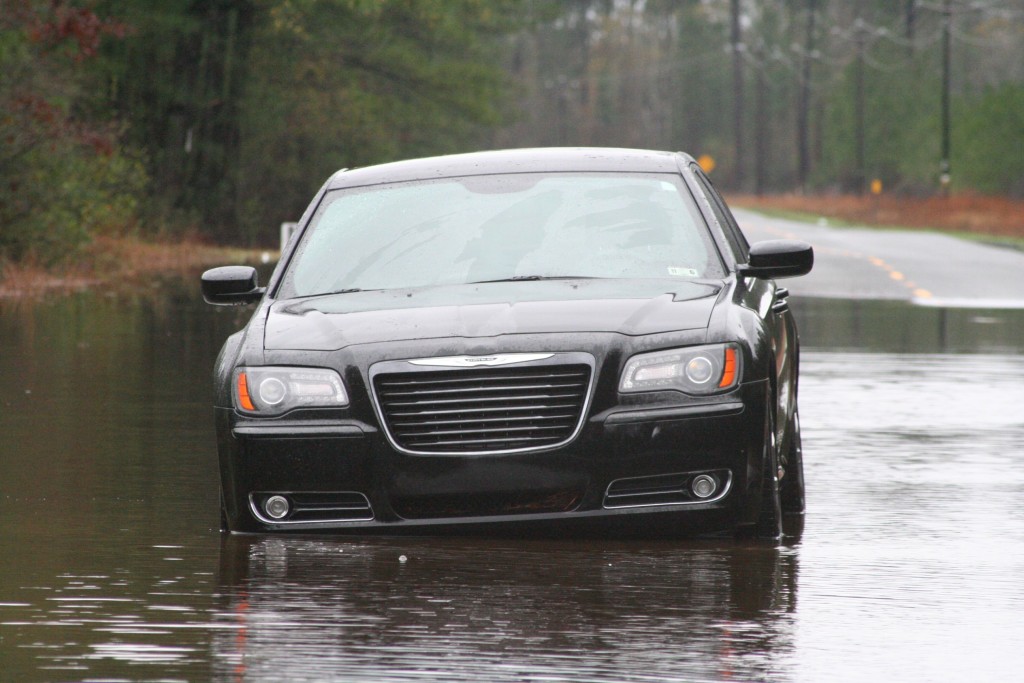
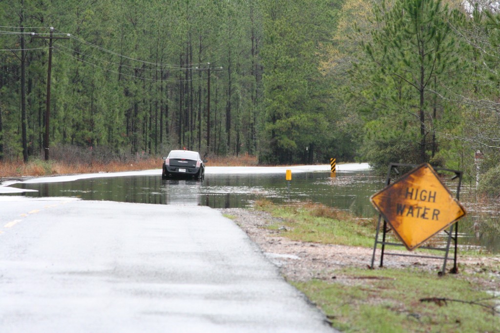
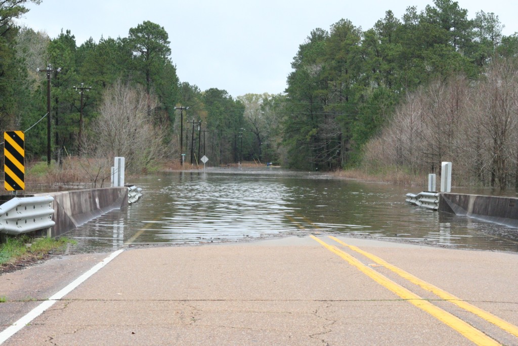
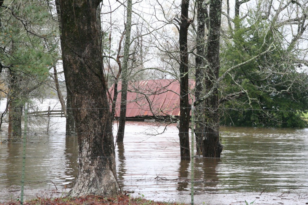
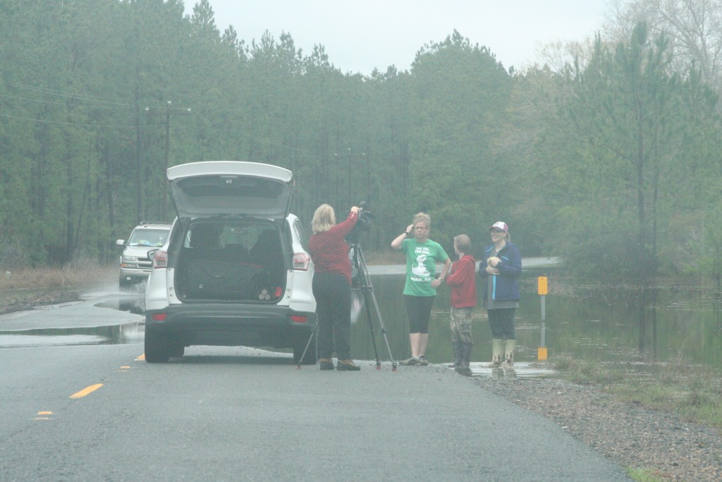
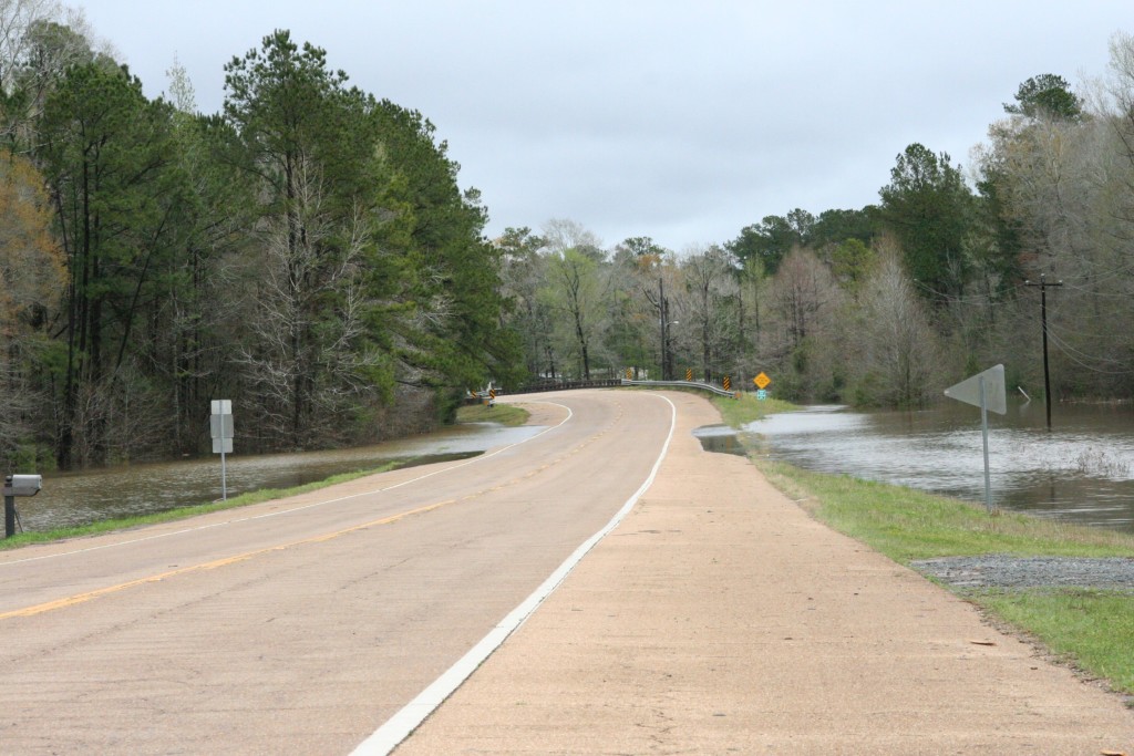
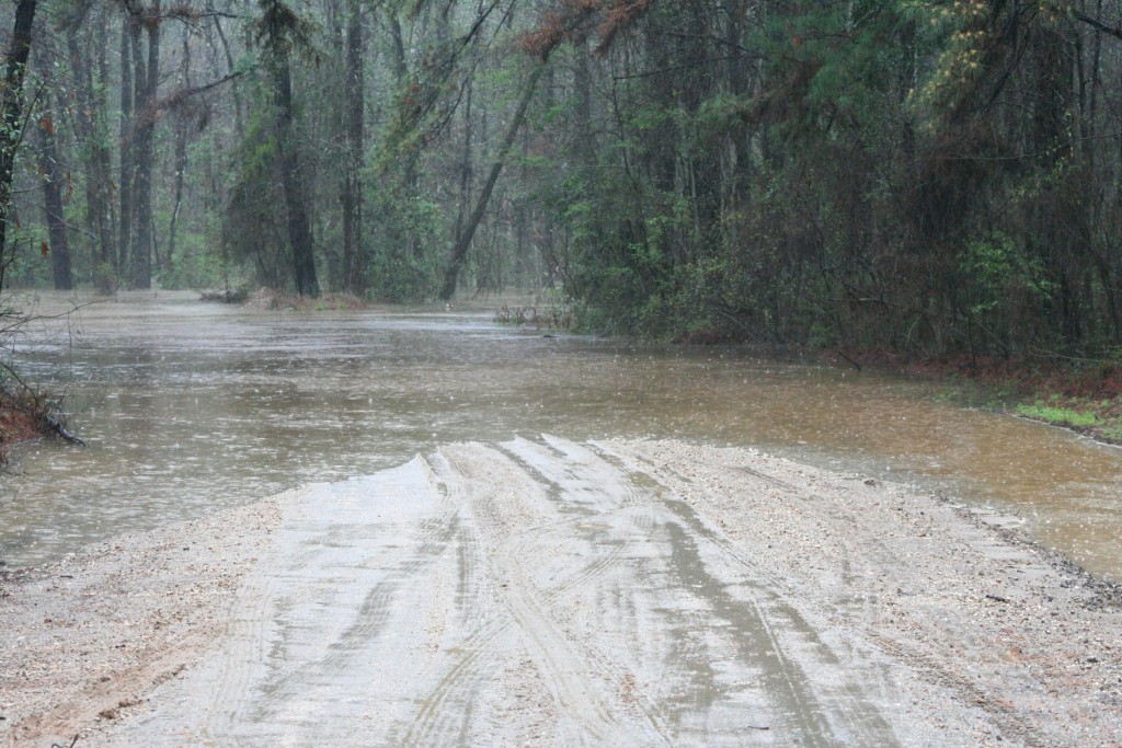
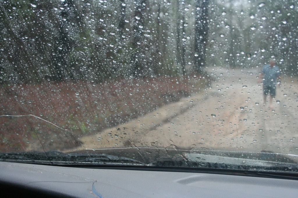
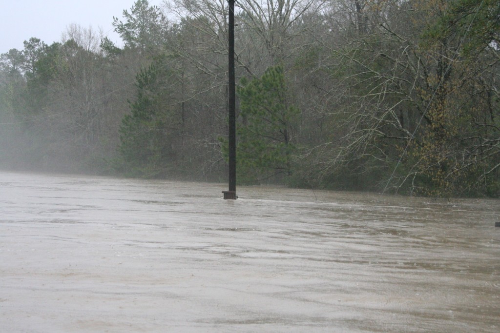
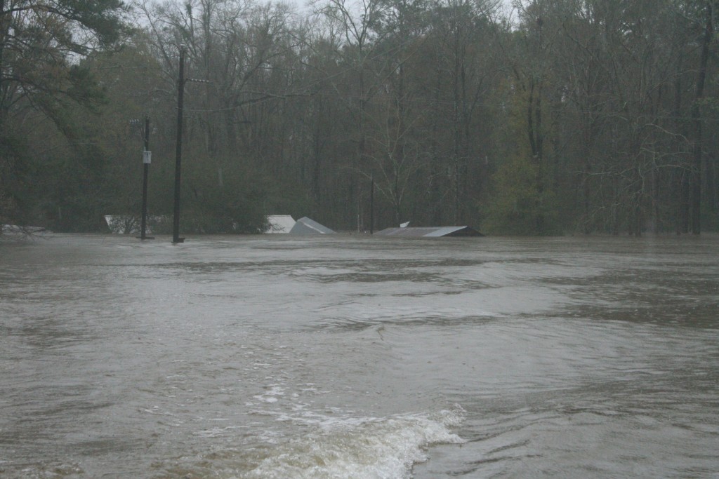
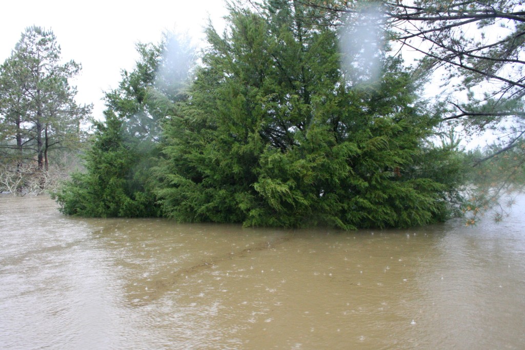
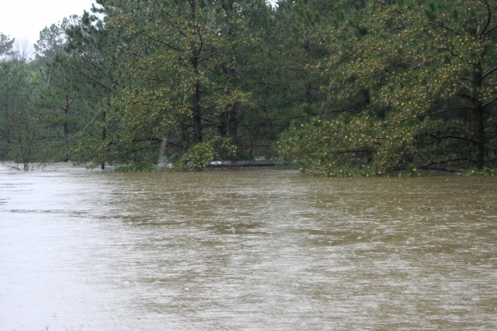
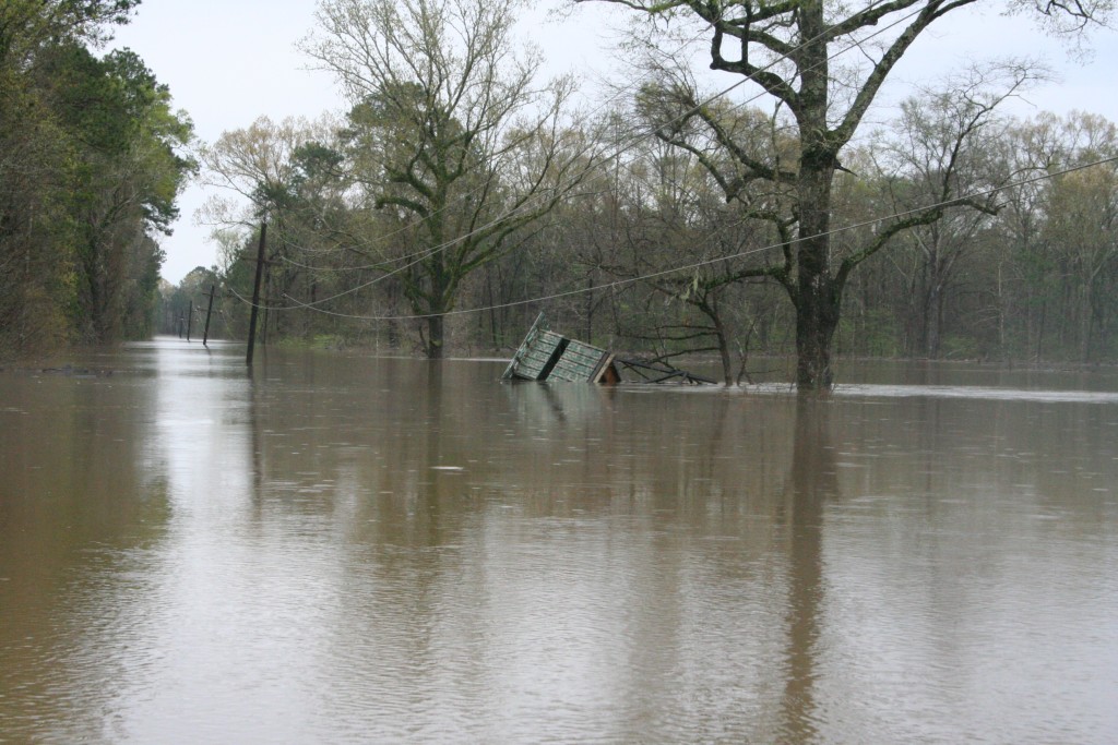
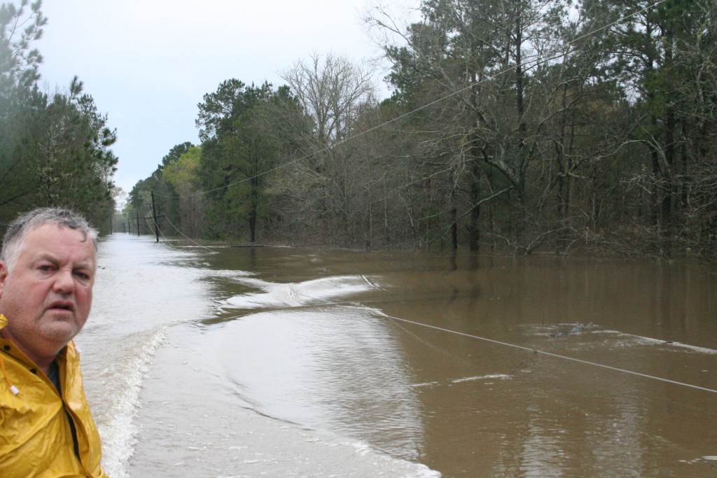
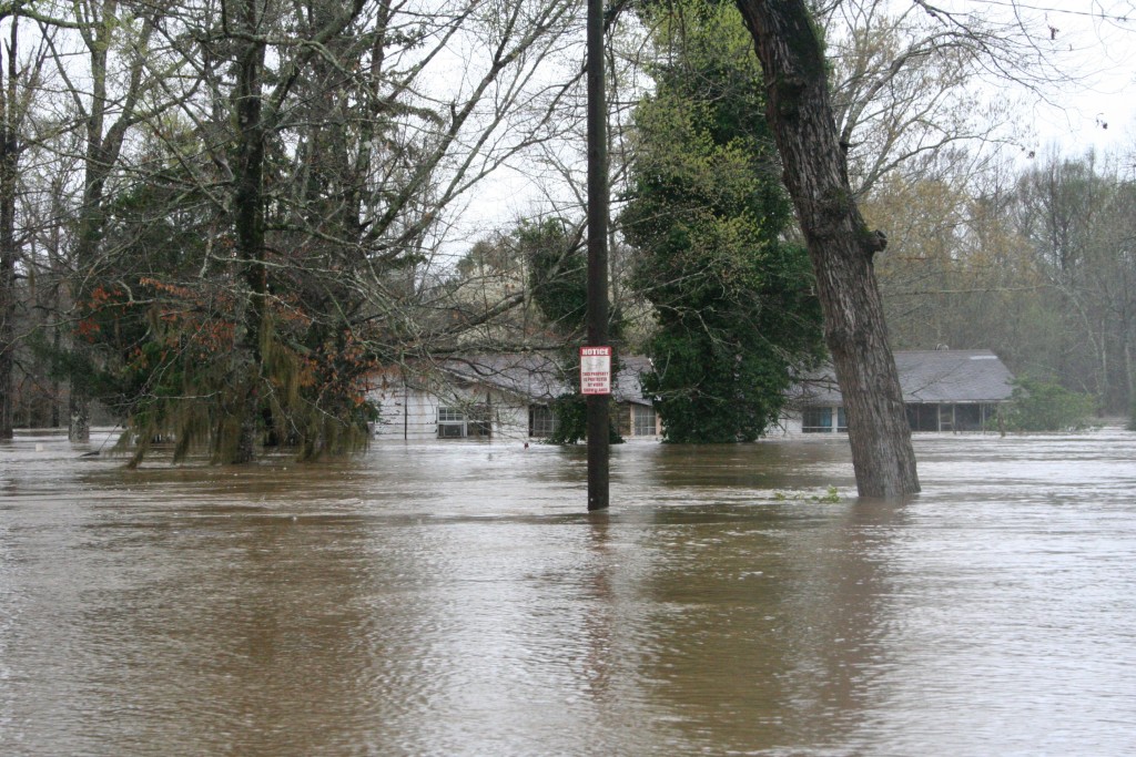
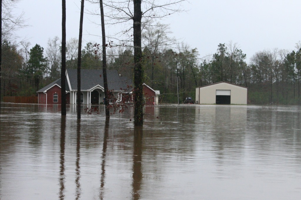
In front of the Welch’s property where they at one point in time dug a (failed) canal. It was hardly ever full of water and it ended up full of vegetation over the years. Not now. The water was very close to the road. Oh, this is on HWY 8, at Anacoco Lake. The first time I have ever known them to draw down their own flood gates because of the water it was holding.Anacoco Lake is unique in our area because it has a nice public boat landing that is merely 50 yards from a major highway. The water covered the boat landing and rose up to the edge of the highway. It has never flooded in such a manner as far as I can recall.This is a little RV park by Anacoco Lake. I think only one or two campers made it, but I am not sure. I know there were some boats that were swamped terribly. I know the boat shed there was only about a foot out of the water. Eerily enough, however, when we were driving last night we noticed someone was in a camper that was absolutely surrounded by water and someone was in there, lights on, watching TV.A better view of the Anacoco Lake RV Park. I don’t know if it has an official name, but I do know there was some damage to some nice campers.In the back you see the boat shed, or boat house or whatever. In the front you see the camper that had someone in it last night. While this place has flooded before, it has never flooded like this.This is the Burr Cemetery Road. The water being this high was alarming. It was raining pretty good when I came here. To the right of this image, up that little ditch, is the actually cemetery. Which hey….The next I would see Burr Cemetery would be less than 24 hours later from the deck of Harvey Nash’s boat. This is how serious this flood has been.Some driveway erosion that the inhabitants of Burr Cemetery Road will have to address eventually.A wash out that will have to be fixed on Lynn Nash Road. There have been worse wash outs and most likely will be some after the waters recede. This is also now about 4 feet underwater.To the left is the Wing Road and to the right is the continuance of Lynn Nash Road. You go right to go to my parents. in past floods, water would rise to this point,and water would just be under my parent’s house. Less than five hours later, water was about 12 inches into my parent’s house.Toro Creek submerged HWY 392 making it impassible and impossible to get to the Toledo Bend dam via my usual route. There were a lot of people there and I really felt like an asshole for being there. I left, but I did get a quick shot. A guy that looked very unofficial, but had a very assertive demeanor made the comment “What are all these fuckin’ people doing here?” That was my cue to leave.This is the gate to Wood Water Tree Farm. I have never heard of it, or I just never paid attention to it. See the debris in the gate? At some point the water was going over highway 111. I actually don’t know if this is a real business or not, but it took a beating.My first of many camera checks. My camera acts funny at times, especially in low lighting situations. Sometimes those camera checks move me. Water should not be in the background here.This is the Texas side of the Burr Ferry river bridge. The water had only been this high once, and that was in 1989. a couple of hours later the bridge was closed and water had begun to pour over the Texas highway. It was at this point that the community started feeling the absolute shock of what was happening. At this time, the water broke record heights, and at this point the water would have been about four feet up the walls of my parent’s house. Eventually, it would rise into their attic.You can see here there is very little space between the bridge and the water. The sheer power of the water amazed me, but the strength of this old bridge has held up to a great many of floods. It’s a shame it is being replaced. If this flood does not dismantle the bridge this time around, it will have earned it’s retirement. I feel like it symbolizes something, I feel like it belongs on a bumper sticker with some phrase about how strength is not about how much you can hold, but how much you can stand against or something. Get on it people!This is the Lynn Davis Road in Evans, LA. I was going to check on my cousin, Jake, but I was in a rush and Didn’t really have time to go around the back way. I figured he was at work as well.This is Jarrel Loop, AKA Uncle Carl Road. I was going to go check on them but after maneuvering around really big logs that floated onto the road I rand into this water. That being said, those logs were on dry land, which means there was an alarming amount of water rushing through here the night of the storms. How no one was killed is amazing to me. I noticed, driving about 150 miles yesterday, that there were signs where water was just having its way all over the place. Anyone that was stuck in any of these spots was probably terrified.A victim of the storms that night. I don’t know the story of the car, but this was the most interesting car of the day. I saw this on my way home via 464…The close up tells me that it’s a Chrysler. What you apparently needed that night was a Mercury out board on a 16 foot long, 8 foot wide flat bed aluminum boat.What came first? The drowned car or the High Water sign?I made it almost to the end of HWY 464, but Anacoco Lake had another idea. This is why it was blocked.I think this may have been an old boat house or barn on Anacoco Lake. It’s sad because the water refuses to allow proper identification.This is what became of the Chrysler. It was used by a news company, I think one out of Lake Charles. It was eventually filmed getting towed and no, I do not know these kids that are being filmed. I don’t even know if the car is theirs. I do know that the lady filming gave me one “go to hell” look when I pulled up that kept me in my car. The reason why it’s hazy is because my windshield. I should have gotten out and went all Paparazzi, but Brandi was waiting on me at this point and I had A LONG way to go.On my way back home I shot this moment where water was almost over the road here. I’ve never seen it this high and I do think it was over the road the night of the storm.
Emotions Start Now
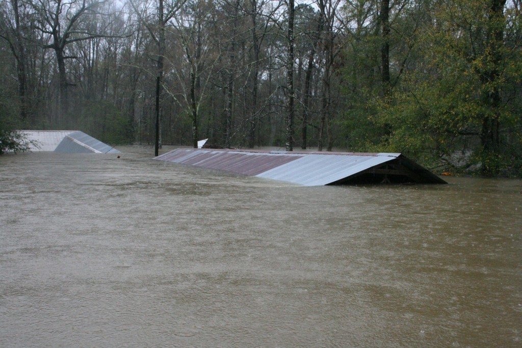
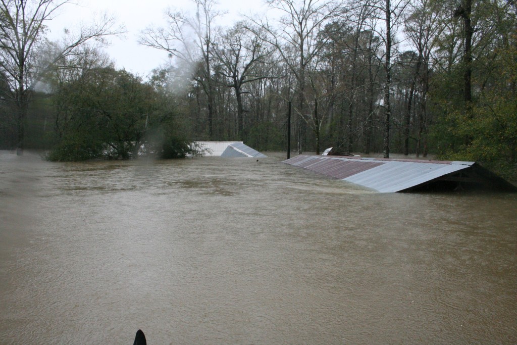
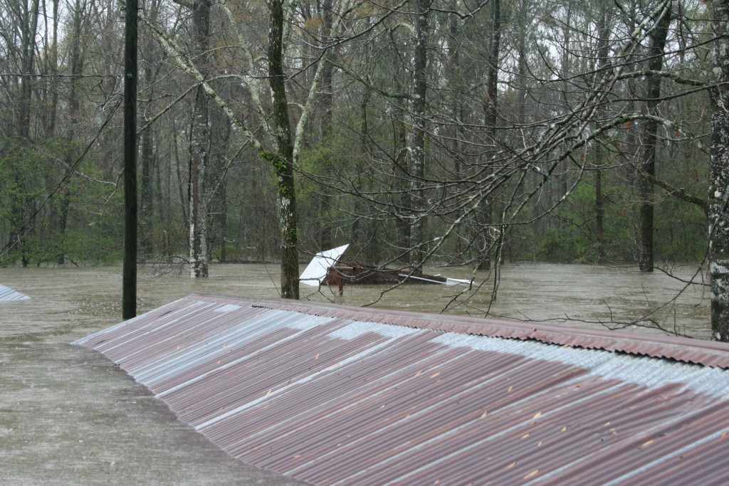
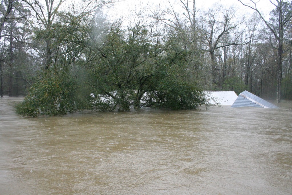
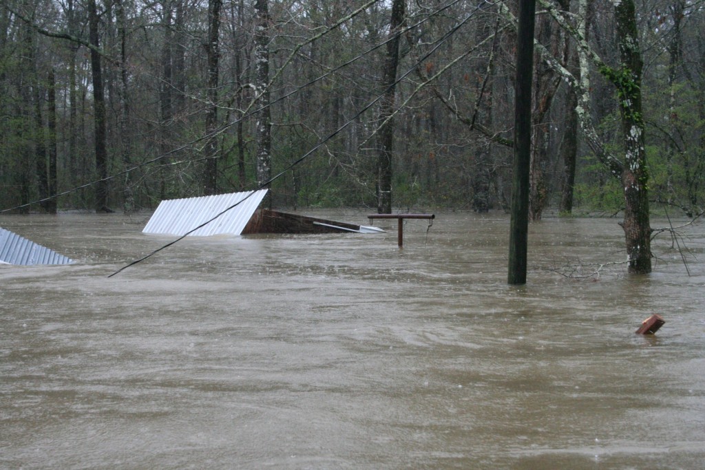
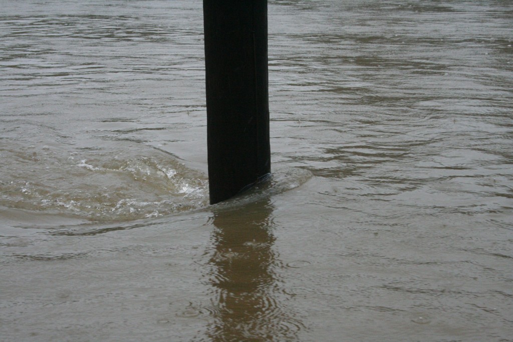
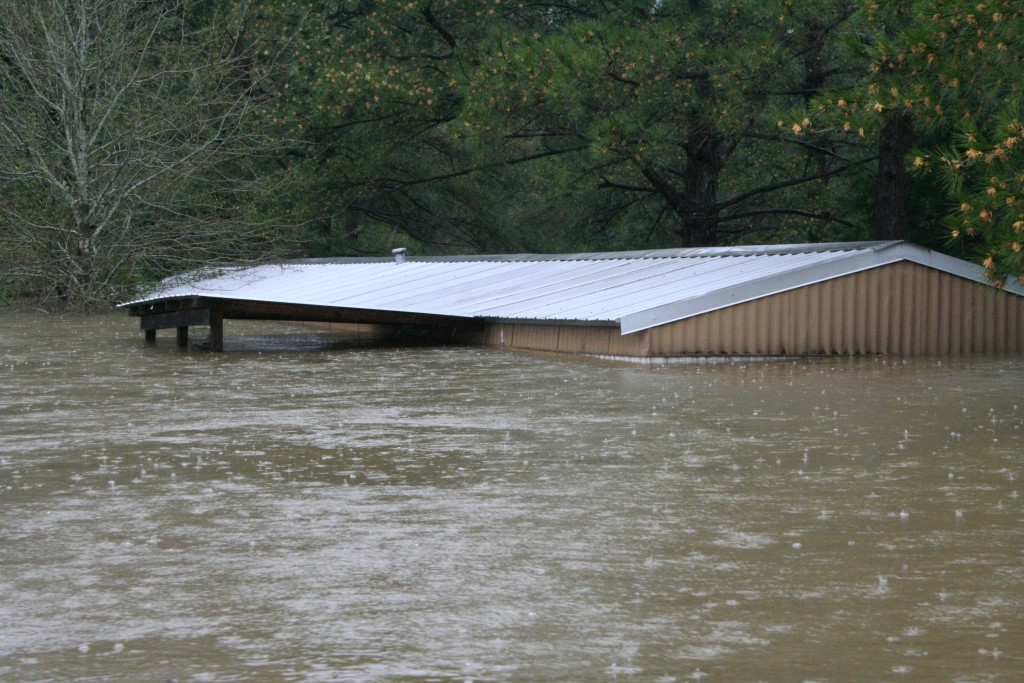
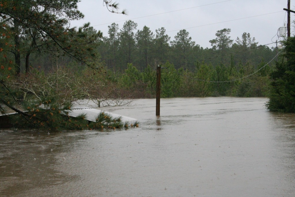
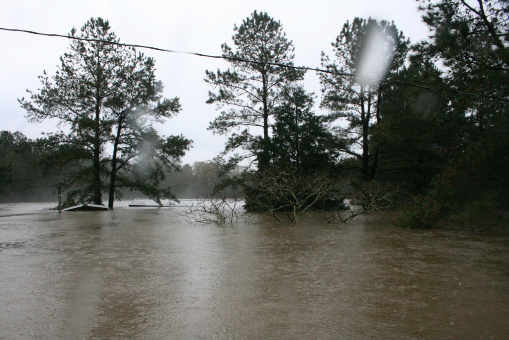
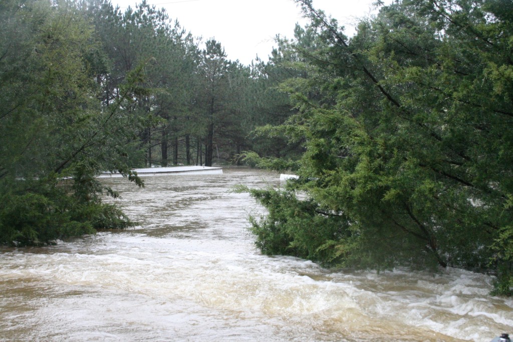
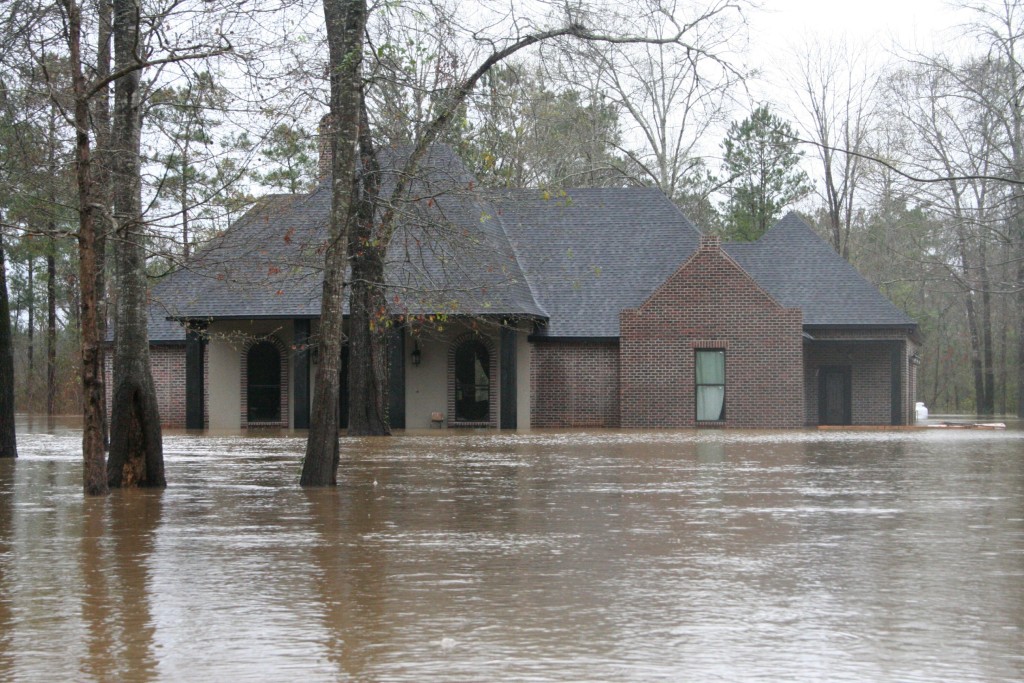
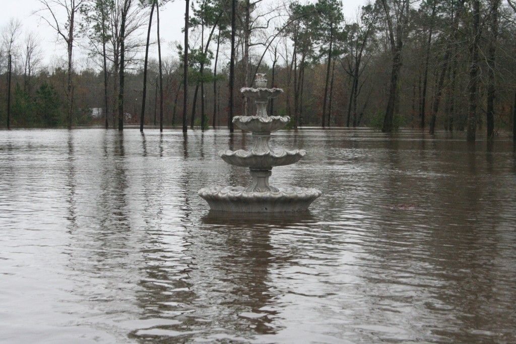
This is where it all hits me. This is my return, today, to Lynn Nash Road. The water has risen and has pushed back about a quarter of a mile. My dad kind of had an “Oh shit” moment. The water had never been this high, and you tell the rain was relentless.A photo check while I was prepping the camera and getting it “rain ready”. Tested my lens to check for moisture and what do you know, I took a photo that, to me, kind of summed up the entire atmosphere and mood of the day. In the back you can see that my dad is trying his damndest, but you know he’s on the verge of breaking.The roof in front is my parent’s carport where my dad’s “little bigfoot” is currently resting. The roof that is all askew to the back/left is the pump shed which has released from the foundation. That pump house was well over 20 years old, and was in perfect condition. The roof the the left, behind the trees? My parent’s house.A wider angle to give you an idea of the house and all the buildings. The building the back/right of the carport is a little storage shed that is currently bobbing like a cork.A better shot of the shed bobbing like a cork. This is no small shed. I believe it was 16 x 26 feet and when the water resides we are going to have a hell of a hard time getting into it.I was speaking with a coworker and friend of mine, Ty Wyatt, tonight and I was explaining to him that when we rode into my parent’s place on a boat, that I had a bracket for a basketball goal that was 11 foot off the ground. My Uncle Carl actually made this for me, and there is is on the light post. That’s how high the water was when we arrived. Eleven. Feet.Following the flood in 1999, my dad had the insane notion that me and him and a couple of hands here and there could lift his house to avoid the next floods. We worked our asses off to get this project done. It wasn’t easy and it completely gave me the notion that not only was my dad a bad ass carpenter, he was some kind of insane engineering wizard. We cut seals and lifted the house and dropped the porch There have been several times in my life where I was part of my dad’s insane plans, and this was one of the memories that make me appreciate the art of not only building, but also remodeling. This new “lifted house” went through several floods unscathed and I remember my dad saying “If water ever gets it my house this time we all in trouble!” My father has this uncanny ability to predict the future, determine outcomes, troubleshoot issues to prevent problems…and..he’s always right. Water got into his house. Everyone’s in trouble now.While this shows the best view of the storage shed, I took this photo with that odd T shaped piece of piping sticking out of the water. There are a few people that know what this is, and have even used it to skin hogs and deer. This skinning pole was one of my dad’s insane projects that I didn’t get to help with (I was out of the house by this point). It was one of the things he was very proud of, and when he builds a new one, I am helping with it. Oh, and that thing is like 15 feet high. We got a good idea of how high the water is now?This is use departing my parent’s place and to the very left, partly out of frame, is my dad’s first big project post house construction. It was his workshop. His workshop was torn from the foundation and is floating. I am terrified of the water receding at this point. I regret not getting a shot of the shed, but the current was making it hard to navigate and my dad’s emotional turmoil was really hindering his maneuvering skills. He was ready to escape this scene.Lens check time. I was having focus issues and I used this light pole to get my focus right. While not much, it shows that flood waters in this area were anything but still and that being in these waters at any point in time are very dangerous.This is the back of my Aunt Joy’s trailer. This trailer was very high off of the ground, and as you can see, it’s sunk. In fact, as I type this, it is most likely completely submerged. My Aunt lost her previous trailer to floodwaters, or well, the damage eventually led to her having to get a new trailer. I believe the Burr Ferry Pentecostal Church helped set this trailer up. They helped get it connected and everything. See, my aunt is currently raising three of her grand daughters, and from this photo, it’s safe to assume, like many others, she has essentially lost everything.This is my Aunt Joy’s pump house (I think). I think it is floating here, but I can’t be sure. I don’t remember it being so tall. The power lines in the background have an interesting backstory. During one flood, and I believe this to be 1999, Ezra, My Aunt’s husband at the time, stayed in and my cousins (Cannon, Creg and Greg Jordan) were with him, or they were going to him in a boat. The power lines broke and hit the water and they apparently walked on water because they made it from their boat to the porch before anything could happen. Or the power wasn’t on at the time.Lens check. Damn water on my lens. I was trying to get my zoom and things rigged up because we were moving fast due to the current and we had more photos to snap. This was actually a beautiful site because the cedars were so green (and have always been this green).This is the whole front of my Aunt Joy’s place. This should give you a better idea of water height.You may be thinking “Lens check?” No, this is no lens check. What you see is the remaining 8 or so inches of Cannon Jordan’s house (I think. The water had me totally discombobulated at this point.)My Aunt Debra’s trailer has fallen off of the cinder blocks. This old trailer survived the 1999 flood, but it had water in it. She and her brood spent quite a bit of time, money, and effort stripping carpet and replacing floors and walls. I don’t believe the trailer, nor any structure in my small, swampy, neighborhood will survive. Also, I could not get a good angle because class 5 rapids and what not.We traveled down the “High Line” (for you unfamiliar folk, the High Line is basically where the power lines run through the woods, and we use them for travel purposes). We were on our way to go up the end of Burr Cemetery Rd. That deer blind is one of my cousin’s (I think).I tried to keep my dad out of frame because he was a mess, but I wanted this photo of the power lines in the water. My dad was worried about the lines being hot. My cousin said they weren’t and I said something like “I guess if you feel a tingling sensation, we’ll know.” I spent a great deal of time trying to redirect my dad’s mind.I’m not sure who lives here anymore, but this is the old William’s place that sits at the end of Burr Cemetery Road. I wonder if the camera’s were still recording?This is Kelli Pennington’s place. We floated by here and eventually went and picked her and Peggy Pennington, and another girl that I could not remember at all. She teaches at Evans, though. When we took them to their house they managed to pack a few bags while me and dad waited in the boat. I was barefooted and was totally not about to walk into an unknown, almost palatial house. It was heartbreaking to see Kelli’s reaction to her brand new house being flooded.This is Kenny Pennington’s house (I think. I don’t really know the Pennington’s well at all. I know their faces, and I talk to them when I see them.) Ran into Kade Mitchell (I think) and the one guy I knew, the ornery Dustin Britain who lost his house completely as he lived on the bank of the river. He was helping out and he was on his way to try to save his boat. It’s always fun to talk to Dustin because if you can find a topic to hit him with, he will NOT stop dropping F bombs about it and it’s hilarious and we needed that.Lens check. I was trying to play with the manual focus, and this was the best I could do. A fountain in the middle of a flood.
I am sitting here in my office at 1:30 AM and I’ll be honest with you. I am crying a little bit. It was very hard to not break down with my dad, but I needed to be his rock for a few moments today. A lot of people in my community are going to need rocks. I will most likely be posting more images of this catastrophe over the course of this nightmare. These photos, again, are very important.
Earlier, at the beginning of this post, I said “What do we have now?”
We have each other, and I learned today that nothing is permanent, except for human connection. Churches, schools, community programs, nonprofits, governmental agencies, families and friends must come together to preserve that one thing. Because that is the one thing that will get us to dry land, clean drinking water, food and shelter.
Please be safe. I fear for all of us in the coming months.